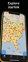
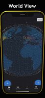
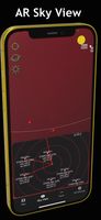
MapSphere is a manageable way to view and organize geographical data of different kind. This might be raster maps and satellite imagery from various sources, your own information received from GPS, tracks of your friends, whatever you want.


MapSphere is a manageable way to view and organize geographical data of different kind. This might be raster maps and satellite imagery from various sources, your own information received from GPS, tracks of your friends, whatever you want.


Easily track satellites so you can see them in the night sky. This free web app provides an easy interface to find where satellites will be located at any given time, even providing a sleek view from the ground using Google Street Maps.