Seametrix
Sea routing software, simulating sea navigation and routing. Essential for voyage planning, calculating sea distances, and estimating sea voyage duration and costs.
Cost / License
- Freemium (Subscription)
- Proprietary
Platforms
- Windows
Seametrix
Seametrix News & Activities
Recent activities
Seametrix information
Developed by
 Seanergix Ltd
 Licensing
Proprietary and Freemium product.Pricing
Subscription ranging between $12 and $33 per month + free version with limited functionality.Alternatives
0 alternatives listedSupported Languages
- English
What is Seametrix?
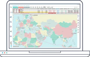
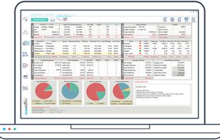
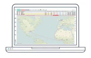
Seametrix software, is a Windows desktop application built for the shipping and maritime industry. Its main function is to simulate sea voyages, calculate distances by sea, and within seconds return sea routing real-world-like results. Seametrix also has a voyage estimation module, so that users can easily and accurately pre-estimate sea voyages, freights and costs. The more advanced version, Seametrix+, has a really unique module with frequent Technical analysis reports, made by Financial Technicians, for financial instruments such as main indices, shipping indices, maritime stocks and commodities among others. Seametrix's development took many years of data analysis, and contains by far the most complete and detailed sea and inland navigational network.