The reference implementation of the Open Geospatial Consortiums WFS and WMS services, GeoServer is a full featured open source software server written in Java that allows users to query, visualize, combine, edit and publish spatial data over the web.
hale connect AlternativesGIS Software and other similar apps like hale connect
hale connect is described as 'Cloud platform for easy and effective transformation and publishing of Open Standards (INSPIRE, OGC, Smart Cities, BIM) data' and is a GIS software in the development category. There are six alternatives to hale connect for a variety of platforms, including Windows, Mac, Linux, Web-based and Chrome OS apps. The best hale connect alternative is GeoServer, which is both free and Open Source. Other great apps like hale connect are Mapserver, TerraVisu, ESRI Geoportal Server and Geoclip.
Alternatives list
 22 GeoServer alternatives


MapServer is an Open Source platform for publishing spatial data and interactive mapping applications to the web. Originally developed in the mid-1990’s at the University of Minnesota, MapServer is released under an MIT-style license, and runs on all major platforms (Windows...


Esri Geoportal Server is a free, open source product that enables discovery and use of geospatial resources including datasets, rasters, and Web services.
Cost / License
- Free
- Open Source
Platforms
- Mac
- Windows
- Linux
- Online


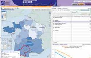
The Géoclip interactive mapping solution is proposed by EMC3. Géoclip permits to publish online thematic atlas or territorial observatories. Géoclip allows you to build web mapping applications for cartographic representations of statistical data.


GeniusGIS is an affordable, robust, Cloud-based Small Business mapping application. Find the ideal location or territory for your business. Access a host of ready-made data sets to help unlock the true value of any geographical location.